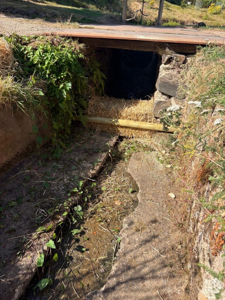
Check Dams and Leaky Dams: Slowing Runoff, Reducing Erosion and Creating Better Habitat
After heavy rain, water rarely travels evenly across a site. It gathers in wheel ruts, gateways, tracks, field drains, ditches and small channels, gaining speed as it moves downhill. The result can be eroded banks, muddy water, lost soil and a rapid surge of runoff arriving downstream.
Check dams and leaky dams are two practical ways of interrupting that process. Both are designed to slow water rather than simply block it, but they are used in different places and need to be designed around the ground, watercourse and consequences of backing water up.
Used well, they can form part of a wider wetland and habitat system, working alongside swales, scrapes, ponds, buffer strips and floodplain features. Used badly, they can redirect water, scour banks, block fish movement or create a maintenance problem. The difference is mostly down to siting, levels and what happens during the largest flows.
What is the difference between a check dam and a leaky dam?
| Feature | Check dam | Leaky dam |
|---|---|---|
| Typical location | Shallow ditch, swale, gully or surface-water flow path | Small stream, winterbourne, woodland channel or defined runoff route |
| Main purpose | Reduce water velocity, trap sediment and limit erosion | Let ordinary flow pass while slowing and spreading higher flows |
| Typical construction | Stone, timber, coir, brushwood or another site-appropriate low barrier | Securely placed trunks and branches with deliberate gaps beneath and between them |
| Water response | Creates a short step or shallow temporary ponding upstream | Has limited effect in normal conditions but holds back and diverts some storm flow onto suitable floodplain |
The names are sometimes used loosely, and some check dams are deliberately porous. The useful distinction is not the label but the intended behaviour: where should the water go at normal flow, during heavy rain and if the structure becomes partly blocked?
Where do check dams work best?
Check dams are generally most useful where runoff is already concentrated into a shallow, stable route. Examples include:
- farm and estate ditches carrying sediment-laden runoff;
- grass swales beside tracks, yards or fields;
- small erosion gullies and seasonal surface-water pathways;
- runoff routes above a pond or wetland where sediment needs to settle first; and
- a stepped treatment system where several small interventions are safer than one large obstruction.
A check dam should normally be low enough that water can pass safely over or through it without cutting around the ends. The downstream face and bed may need protection where falling water could cause scour. A series of modest structures often performs better than a single high barrier because the energy is reduced in stages.
Current GOV.UK check-dam guidance describes their use in ditches, swales and surface-water pathways to slow water, settle sediment and reduce pollution. It also makes clear that they should not restrict migratory fish or eels.
Where do leaky dams work best?
A leaky dam is usually a woody structure positioned across a small channel. It mimics part of the effect of naturally fallen trees: everyday flow continues through gaps, while higher water meets more resistance and is temporarily held back or encouraged onto a suitable floodplain.
Suitable locations tend to have stable banks, room for water to spread without affecting buildings, roads or neighbouring land, and no immediate downstream pinch point such as a culvert or bridge. They are often installed as a sequence across a catchment rather than as an isolated feature.
They are not simply logs dropped into a stream. Timber needs to be stable during flood flows, the normal-flow gap needs to remain functional, and the design must account for debris, bank erosion, fish passage and safe exceedance. Current GOV.UK guidance for small leaky woody dams includes these principles and stresses the importance of stable banks, avoiding pinch points and checking the structure regularly.
How slowing runoff can reduce erosion and improve water quality
Fast water has more energy to detach and carry soil. Slowing it gives suspended sediment a chance to settle before it reaches a pond, stream or river. This can protect downstream habitats from repeated pulses of silt and reduce the movement of nutrients and other pollutants attached to soil particles.
The objective is not to trap every grain of sediment indefinitely. A feature that collects silt needs space, access and a realistic maintenance plan. In some locations a small offline sediment pool, vegetated swale or scrape will be easier to inspect and manage than an in-channel structure.
Wildlife benefits: more than flood control
Water moving through a simplified, straight channel creates limited habitat. A carefully designed sequence of woody barriers, shallow pools, damp margins and temporarily wetted ground creates more variation in depth, velocity, shade and substrate.
- Woody material provides structure for aquatic invertebrates, fungi and mosses.
- Shallow backwaters and damp margins can create feeding and refuge areas.
- Temporary wetting can help reconnect a channel with its floodplain.
- Settling sediment upstream can reduce pressure on cleaner gravel and pond habitats downstream.
- Connected farm ponds, scrapes and wetlands provide a wider range of permanent and seasonal habitat.
The best result is usually a connected mosaic rather than a single structure. The Environment Agency describes natural flood management as using natural processes to slow and store water, with wider benefits for habitat, biodiversity and water quality. We looked at the wider assessment and maintenance principles in our guide to the Environment Agency nature-based solutions handbook.
Common mistakes with check dams and leaky dams
- Starting with the structure rather than the site. A photograph of a successful dam elsewhere does not show its levels, catchment or flood route.
- Building one barrier too high. This can create excessive backing-up, instability and erosion around the ends.
- Blocking normal flow. A leaky dam should remain leaky and must not become an unintended solid weir.
- Ignoring the bypass route. Water will find another route when capacity is exceeded; that route must be safe.
- Placing a feature immediately above a culvert, bridge or vulnerable bank. Trapped debris and raised water levels can increase risk at the worst point.
- Forgetting maintenance. Sediment, branches and leaf litter change how a structure behaves over time.
- Treating a downstream symptom without addressing the catchment. Soil condition, field access, tracks, drains and land management may be generating the problem upstream.
Do check dams and leaky dams need consent?
Often, yes. Consent depends on where the work sits and how it affects flow.
- Main rivers and flood defences: work on or near a main river, flood defence or certain floodplain locations may require an Environment Agency flood risk activity permit.
- Ordinary watercourses: structures that alter or obstruct flow may require Ordinary Watercourse Consent from the Lead Local Flood Authority or Internal Drainage Board. Devon County Council’s natural flood management guidance specifically includes leaky dams and other flow-control works.
- Designated sites: work on an SSSI may need Natural England assent, as well as any other relevant permissions.
- Planning, ecology and neighbours: planning requirements, protected species, fish passage, archaeology and effects on neighbouring land may all need consideration.
Check the route before starting work. The official GOV.UK watercourse permissions guide explains the distinction between main rivers and other watercourses. For more complex sites, a proportionate hydrology and water-management assessment can establish the flow routes, constraints and evidence needed for design or consent.
What maintenance is required?
Every structure should be inspected after the first significant rainfall and then at intervals suited to the site, particularly after storms. Checks should include:
- whether timber, stone or anchoring has moved;
- new scour beneath, beside or downstream of the structure;
- water cutting around the ends or creating an unsafe bypass;
- debris blocking the intended low-flow gap;
- the depth and location of accumulated sediment; and
- effects on banks, nearby infrastructure, access and neighbouring land.
Maintenance should preserve the intended hydraulic behaviour, not automatically clear away every branch or patch of vegetation. Before-and-after photographs and a short inspection record make changes easier to understand.
Combining check dams and leaky dams with ponds, swales and wetlands
These features are strongest when each part of the landscape has a clear job. A typical system might use:
- better soil cover, field-edge vegetation and track drainage to reduce runoff at source;
- shallow swales and check dams to slow and filter concentrated surface water;
- leaky woody structures in suitable small channels to delay higher flows;
- offline scrapes, seasonal pools or sediment ponds to provide storage and habitat; and
- larger ponds, wetland margins and floodplain features to hold water in the landscape for longer.
This is the principle behind practical natural flood management: several modest, maintainable interventions spread through the right parts of a catchment, rather than one structure expected to solve everything.
What should you send for an initial review?
For a farm, estate, conservation or larger private site in Devon or Cornwall, useful starting information includes:
- the site address and a map showing the affected watercourse or runoff route;
- wide photographs in dry conditions and, if safe, during or soon after heavy rain;
- the approximate channel, ditch or gully dimensions;
- known springs, drains, culverts, bridges, ponds, buildings and neighbouring land;
- the main problem and desired outcome—erosion, sediment, flooding, water quality, habitat or a combination;
- existing surveys, designs, grant requirements or discussions with regulators; and
- machinery access and whether suitable timber, stone or excavated material is available onsite.
Planning check dams, leaky dams or a wider runoff and wetland scheme? Send the site details through our large ponds, lakes, wetlands and landowner enquiry form. We can review the flow route, constraints and likely next step before recommending design work, a site assessment or construction.
Frequently asked questions
Do check dams stop flooding?
No single check dam should be treated as a flood-prevention guarantee. A series of well-sited features can slow runoff and reduce the peak arriving downstream, especially when combined with soil, swale, pond, wetland and floodplain measures.
Does a leaky dam create a permanent pond?
Usually not. It is normally designed to pass everyday flow and temporarily hold back or spread higher flows. Persistent deep impoundment may indicate that the feature is too restrictive, has become blocked or is behaving differently from the design.
Can I build a leaky dam in a ditch without permission?
Do not assume so. If the ditch is an ordinary watercourse and the work alters or obstructs flow, Ordinary Watercourse Consent may be required. Main-river work follows a different Environment Agency permitting route.
Are leaky dams the same as beaver dams?
No. They imitate one useful effect of natural woody obstructions—slowing and spreading water—but a constructed leaky dam is a fixed intervention designed for a particular site. A beaver system is dynamic and continually altered by the animals and changing flows.
Is one large dam better than several small ones?
Usually not. Several low, proportionate features can reduce energy in stages and spread both benefit and risk. The right number and spacing depend on channel dimensions, gradient, floodplain space, materials and the consequences of blockage or failure.