Why Wetter Land Matters: Fire Resilience, Water Security and Wildlife
For generations, much of the British landscape has been managed to move water away as quickly as possible. Fields have been drained, streams straightened, floodplains disconnected and wet corners treated as wasted ground.
That approach can leave land less able to cope with both extremes: intense rainfall in winter and prolonged dry weather in spring and summer. As hotter, drier periods increase the risk of vegetation and peat fires, restoring water to suitable parts of the landscape is becoming an increasingly practical form of resilience.
“Wetter land” does not mean flooding productive fields or turning every property into a marsh. It means understanding where water naturally wants to collect, then using well-designed ponds, scrapes, wetlands, wet grassland, backwaters and restored floodplain features to hold the right amount of water in the right places.
Why Wildfire Risk Is Relevant in the UK
Wildfire is not only a problem for hotter countries. Forest Research identifies two important UK fire-risk periods: late winter and spring, when dead grass, bracken and other ground vegetation can be extremely dry, and summer, when heatwaves and drought can produce more intense fires. It also warns that a changing climate is likely to increase the risk and may extend the fire season.
Dry peat is a particular concern. A surface fire can move quickly through grass, heather or gorse, but a ground fire can consume peat and organic soil, damage a major carbon store and continue smouldering below the surface. These fires can be difficult to extinguish and may reignite.
The aim is not to claim that a pond or wetland can prevent every fire. Ignition sources, wind, vegetation, access, land management and extreme weather all affect risk. The opportunity is to create a landscape that retains more moisture, contains fewer extensive areas of dry fuel and is better able to withstand a fire if one occurs.
How Wetter Ground Can Improve Fire Resilience
Water changes how a landscape responds to heat. Moist soils and healthy wetland vegetation are generally harder to ignite than dry organic ground. On peatland, restoring a more natural water table can help stop the peat itself becoming such a vulnerable fuel.
There is an encouraging real-world example from Wales. Following a wildfire in 2025, Natural Resources Wales reported that rewetted areas at Llyn Gorast remained visibly resilient, with wet pools and recovering sphagnum appearing to stall the fire while adjoining unrestored ground was scorched.
A connected network of wet features may help in several ways:
- higher soil and peat moisture can make ignition and deep burning less likely;
- ponds, wet swales, ditches and saturated hollows can interrupt continuous stretches of dry vegetation;
- wet refuges can give wildlife somewhere to escape heat and smoke;
- retained water may support emergency response, provided access and safe abstraction have been considered; and
- a varied habitat mosaic is usually more resilient than one large, uniform block of vegetation.
Design and management remain essential. A neglected area of dense, dry reed, rush, bracken or scrub can still carry fire. Rewetting should sit alongside appropriate grazing, cutting, firebreak planning, access management and control of ignition sources. The strongest scheme considers water, habitat and wildfire management together.
The Benefits Reach Far Beyond Fire
Fire resilience is one reason to hold more water in the landscape, but it is rarely the only one. A well-positioned wetland feature can deliver several benefits from the same area of land.
Greater resilience during drought
Land that sheds every drop of rainfall quickly may have little reserve when dry weather arrives. Wetlands, ponds, healthier soils and reconnected floodplains can retain water for longer, maintain damp refuges and support more resilient aquatic habitats. They can also contribute to groundwater recharge and more sustained flows where local geology and hydrology allow.
Slower runoff during heavy rain
Scrapes, swales, ponds, bunded features and floodplain wetlands can temporarily store water and slow its route through a catchment. This does not mean that any pond automatically prevents flooding: storage volume, location, soil, overflow levels and timing all determine the result. However, well-planned features can form a valuable part of wider natural flood management.
Cleaner water and less sediment movement
Slowing runoff can allow some sediment to settle before it reaches a stream, river or pond lower down. Vegetated margins can also filter runoff and reduce bank erosion. These are useful benefits for connected ponds and watercourses, particularly where silt has become a recurring maintenance problem.
Richer and more connected habitat
Shallow water, damp ground, muddy margins, wet grassland and permanent ponds all support different species. Used together, they create breeding, feeding and refuge habitat for amphibians, aquatic invertebrates, birds, bats and small mammals. A network of varied features is usually more valuable than one isolated, steep-sided pond.
Protecting carbon-rich soils
Where peat is present, water management has an additional role. Keeping peat in a healthy, wet condition helps protect the carbon already stored in the soil and reduces the chance of that store being lost through oxidation or fire. Peatland work is specialist and must respond to the site’s existing ecology, drainage and ground conditions.
What “Making Land Wetter” Can Look Like
There is no single wetland design that suits every property. The right intervention may be surprisingly modest and can often focus on land that is already awkward to drain or difficult to use.
- Seasonal scrapes: broad, shallow depressions that hold winter water and may partly or completely dry in summer.
- Wildlife ponds: permanent water with gently shelving banks, varied depths and well-planted margins.
- Wet grassland: seasonally inundated ground managed to retain a mixture of open sward, rushes and damp hollows.
- Runoff attenuation features: swales, bunds, offline ponds and field-edge storage designed to slow, store and filter water.
- Floodplain reconnection: restoring carefully selected areas where a river can safely spread during higher flows.
- Fish refuges and river backwaters: sheltered side-water habitat connected appropriately to a stream or river, creating varied depths, damp margins and refuge from fast flows without placing a conventional pond across the channel.
- Pond and ditch restoration: bringing neglected water features back into a useful habitat network while retaining the drainage functions that are genuinely needed.
Where a stream or river crosses a property, a carefully designed fish-refuge or backwater can be an especially useful part of this wetter habitat network. As well as creating sheltered water for fish and other wildlife, the feature can extend damp riverside habitat and add another break in an otherwise continuous area of dry ground vegetation. It should not be sold as a stand-alone firebreak, but it can contribute to a more varied and moisture-retentive landscape.
The Environment Agency’s 2026 position statement on nature-based solutions recognises this broad range of measures, from ponds, bunds and swales to wetland restoration and floodplain reconnection. It also makes clear that small farm- and sub-catchment-scale projects can be beneficial when they are properly planned and, ideally, connected to wider catchment objectives.
Good Design Is What Turns Water into an Asset
A successful scheme starts with the site rather than a standard drawing. Before excavation or drainage changes begin, the design should consider:
- where water comes from and where it currently goes;
- how levels change between winter, summer and drought;
- soil, geology, groundwater and whether the ground will retain water naturally;
- safe overflow routes and the effect on neighbouring land, buildings, tracks and services;
- existing habitats, protected sites and protected species;
- vegetation management, livestock access and future maintenance;
- fire-service access, water availability and the position of important assets; and
- whether planning permission, land-drainage consent, an environmental permit or another approval is required.
This is not a case of blocking a stream and hoping for the best. The opportunity is to create several well-connected, varied habitats that store water safely and continue to work through changing seasons. Often, the best starting point is a wet corner, old pond, shallow valley, spring line or field-edge flow path that the landscape is already showing us.
Why This Is a Timely Opportunity for Landowners
The direction of travel is increasingly supportive of well-designed nature-based water management. Recent Environment Agency guidance gives clearer recognition to the value of wetland creation, runoff attenuation and river and floodplain restoration for water resilience. There are also grant and land-management schemes that may support appropriate pond and wetland work, although eligibility and funding availability must always be checked for the individual holding.
For farmers, estates and rural property owners, this creates a chance to look again at land that has historically been treated only as a drainage problem. A carefully planned wetland can remain compatible with productive land management while providing stronger habitat, cleaner water and greater resilience to both dry and wet extremes.
Planning a Wetter, More Resilient Landscape in Devon or Cornwall
SAS Aquatics designs and creates wildlife ponds, seasonal scrapes, wetlands, backwaters and connected habitat schemes across Devon and Cornwall. We can help assess water movement, identify realistic opportunities, develop the concept, check likely permissions and construct a feature that fits the land.
Explore our wetland creation and rewilding service, read more about fish-refuge and river backwater habitat, or tell us about your land and the water opportunities you have noticed.
A wetter landscape does not have to be an unproductive one. In the right places, water is infrastructure: it supports wildlife, protects soils, improves resilience and gives the land more ways to cope with an uncertain climate.
Further reading
- Forest Research: wildfire risk and land management
- Natural Resources Wales: evidence from the Llyn Gorast wildfire
- Environment Agency: nature-based solutions for sustainable water resources
- Environment Agency: evidence on river and floodplain management
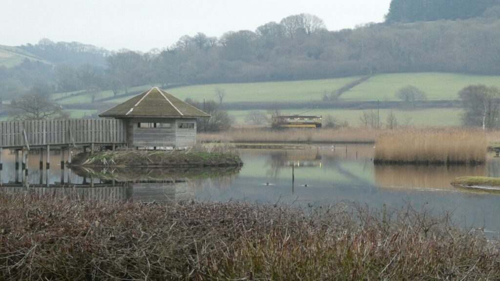
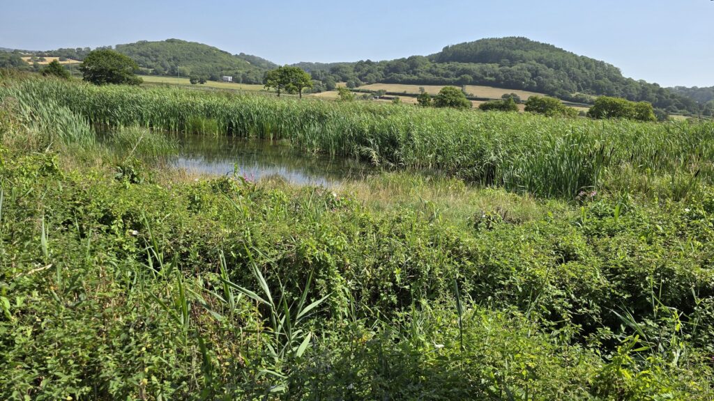
Photo: Seaton Wetlands reedbed by Lee Vilenski, via Wikimedia Commons, licensed under CC BY-SA 4.0. Image cropped for website use.