Spring, Seepage or Surface Runoff? How to Read Wet Ground Before Designing a Pond
Wet ground does not automatically mean there is a spring. Water may be rising from below, seeping out along a soil boundary, running off the field after rain, escaping from a land drain or simply sitting above a slow-draining layer. Those sources behave differently, and the difference matters before anyone decides where to excavate a pond or wetland.
On land in Devon and Cornwall, the right answer rarely comes from one wet-weather visit. The useful evidence is how the water appears, where it travels, how long it lasts and what happens when the weather turns dry.
Why the water source changes the design
A pond fed by clean, dependable groundwater is a different proposition from a hollow that fills with silty runoff after a storm. One may hold a relatively stable level. The other may swing between overflowing and drying out. A damp line across a slope may already be a valuable seepage habitat rather than an empty place waiting to be dug up.
Before drawing a pond shape, we need to understand five things:
- where the water comes from;
- how the flow changes through the year;
- what land drains into it;
- whether the water is likely to carry sediment, nutrients or other pollutants; and
- where excess water can leave without causing a problem elsewhere.
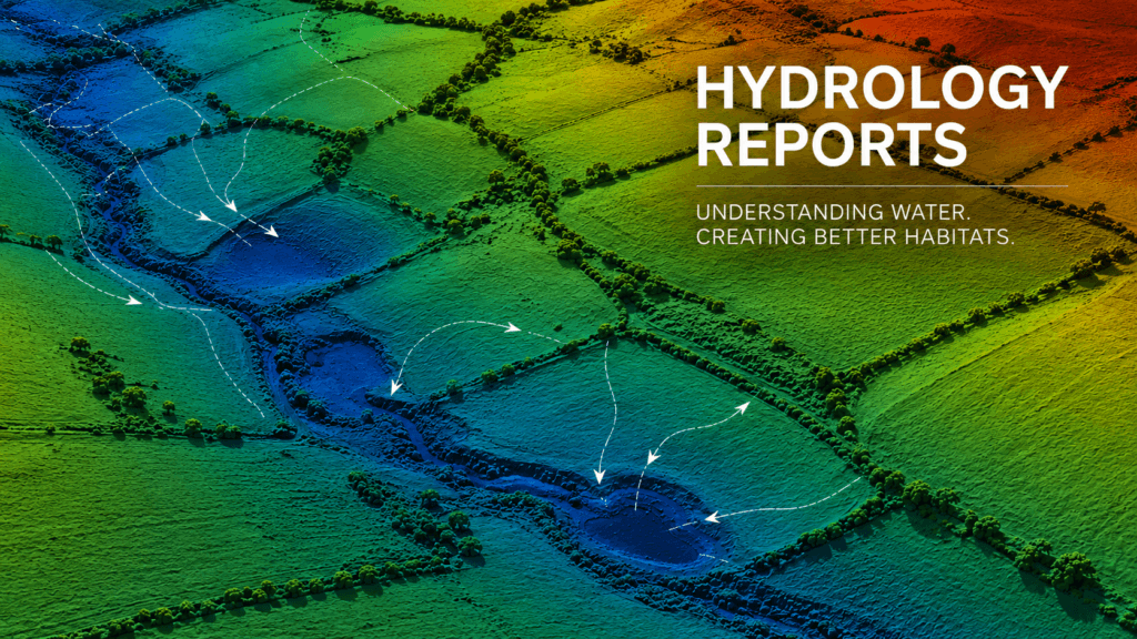
This is why we treat hydrology as part of the site design, not as something to solve after excavation. Our hydrology and water-management assessments are intended to turn those observations into a practical plan.
What does a spring look like?
A spring is groundwater reaching the surface. It may appear as a distinct emergence point, a small pool, a clear flow from the base of a bank or a short channel beginning where there is no obvious upstream catchment.
Possible indicators include:
- flow continuing after a reasonable spell without rain;
- a repeatable emergence point rather than water spread across the whole slope;
- clear water appearing from the ground or a bank;
- a local relationship with geology, a change in slope or a boundary between permeable and less-permeable material; and
- nearby place names, historic maps or local knowledge suggesting a longstanding source.
None of those clues proves that a permanent spring is present. Some springs are strongly seasonal and their apparent source can move upslope or downslope as groundwater levels change. A broken or intercepted land drain can also look remarkably spring-like.
The mistake is to see flowing water in January and assume it will still be there in August.
What does seepage look like?
Seepage is usually more diffuse. Instead of one obvious point, water may emerge along a line, across the face of a bank or through a broader patch of saturated ground. On a slope, it can follow the boundary between two soil or geological layers.
You may see a permanently soft strip, several small wet spots, shallow surface movement or a change in vegetation. The ground can remain wet even when there is little visible flow.
A seepage or flush can be important habitat in its own right. The Freshwater Habitats Trust pond-creation guidance warns against simply digging up existing springs, flushes and damp hollows. Often the better answer is to protect the wet feature and place a new pond beside it, provided the surrounding land is suitable.
What does surface runoff look like?
Surface runoff is rainfall moving over or just below the ground towards a low point. It often arrives quickly during heavy rain, follows wheelings, tracks, gateways, ditches and compacted areas, then reduces or disappears when the event passes.
Clues include:
- sheet flow across a slope or a visible route through grass;
- muddy water carrying fine sediment;
- erosion, deposited silt or flattened vegetation;
- water collecting below a gateway, yard, road, roof outlet or compacted track; and
- a strong response to rainfall with little or no flow in settled weather.
Runoff is not automatically unsuitable for a wildlife pond. Its value depends on the catchment. Water draining from rough grassland may be useful. Water from intensively managed ground, roads, yards or eroding tracks may bring nutrients, sediment, oil or other contamination. The water source and the land above the pond have to be considered together.
Could it be a drain or a high water table?
Not every point source is natural. Older field drains are not always accurately mapped, and some may be damaged, blocked or discharging at an unexpected point. A pipe, straight wet line, inspection chamber or flow that closely follows rainfall can indicate a drainage connection.
A high water table looks different again. Saturation may cover a wider low-lying area, and trial holes may fill to a similar level rather than revealing one clear source. Groundwater levels can rise and fall substantially through the year, so a winter test alone does not show the likely summer level.
It is also possible for several sources to overlap. A field might receive groundwater seepage, rainfall runoff and a drain outfall at the same time. The aim is not always to attach one neat label. It is to understand which source controls the proposed feature in wet and dry conditions.
How we investigate wet ground before designing a pond
1. Start with the landform and catchment
We map the high and low ground, slopes, channels, ditches, tracks, buildings and likely flow routes. The question is not just “where is it wet?” but “what area supplies this point with water?”
Historic maps, geological information, flood-risk mapping and environmental constraints can all add context. The government’s long-term flood-risk service distinguishes surface-water, river, reservoir and, where available, groundwater risk. Defra’s MAGIC Map is also useful for checking environmental designations and landscape information, although neither replaces evidence from the site.
2. Compare dry-weather and post-rain conditions
A visit immediately after heavy rain shows flow routes, but it can exaggerate a source that is absent for most of the year. A dry-weather visit shows what persists. Where the decision matters, repeated observations are far more useful than a snapshot.
Landowners can help by taking photographs from the same positions after heavy rain and again after a dry spell. Dates, recent rainfall and simple notes on how long the flow continued make those photographs much more valuable.
3. Trace the water both uphill and downhill
We follow the wet line upslope to look for an emergence point, pipe, ditch, gateway or change in ground conditions. We also trace it downhill to understand its destination. A pond needs a safe overflow route, and creating a bund or intercepting a drain can move water onto neighbouring land or increase flood risk.
4. Check soils and, where appropriate, use trial holes
Soil texture, depth and changes between layers help explain how water is moving and whether an unlined basin is realistic. Properly located trial holes can show where water enters and how the level changes. They must be planned around services, ground stability, access and existing habitat.
Leaving suitable test holes to be monitored through changing conditions is more informative than seeing water appear once. Wet soil does not necessarily mean the ground will seal a pond.
5. Test water only when it answers a useful question
Water clarity, sediment and surrounding land use give useful first clues. Laboratory testing may be justified where water quality will affect the design, but a single result does not prove where the water came from. Chemistry supports the wider site evidence; it does not replace it.
Common mistakes when reading a wet field
- Calling every wet patch a spring. A rain-fed hollow, leaking drain or perched water layer can produce similar symptoms.
- Visiting only in winter. A strong January flow may not support a permanent pond through summer.
- Digging directly into the wettest habitat. The existing seepage, flush or seasonal pool may be more valuable left intact.
- Sending all available runoff into one pond. This can import silt and nutrients and create an avoidable overflow problem.
- Assuming water supply and water retention are the same issue. A site may receive plenty of water but still leak rapidly.
- Ignoring where the water goes next. Blocking or redirecting a flow route can affect a ditch, watercourse, field drain or neighbouring property.
What the evidence can lead to
Once the source is understood, the design can follow the site rather than fight it.
- A clean, persistent spring or seepage may support a pond or wetland, but the source and overflow still need protecting.
- A valuable existing flush may be retained, with a new pond placed nearby rather than on top of it.
- Rainfall runoff may suit a seasonal scrape, swale or sediment-control feature before water reaches a separate wildlife pond.
- A high seasonal water table may favour a shallow, naturally fluctuating wetland rather than a deep permanent pond.
- A drain-fed location may need the drainage network investigating before any interception or excavation is considered.
- Poor-quality inflow may make an offline pond in a cleaner part of the site the stronger option.
For a broader look at those choices, see our guide to turning wet ground into a wildlife pond or wetland. If the proposed source is an established channel, our article on river- and stream-fed ponds explains why an offline design is often safer.
Permissions and existing habitat still matter
If work would alter a ditch, culvert, stream, bank, floodplain flow route or land drainage system, permissions may be needed. The Environment Agency’s watercourse guidance explains that even channels that are dry for long periods can count as watercourses and directs landowners to the relevant risk-management authority.
The site should also be checked for protected habitats, species, archaeology and existing wetland value before excavation. This is particularly important where a “problem wet patch” may already be functioning as a spring, flush or seasonal pool.
Planning a pond or wetland in Devon or Cornwall?
SAS Aquatics designs and delivers wildlife ponds for landowners and wetland and rewilding projects across Devon and Cornwall. We can assess the catchment, likely water sources, soils, access, overflow and environmental constraints before recommending whether the right answer is a pond, scrape, wetland, runoff-control feature or no excavation at all.
Tell us about your landowner pond or wetland project. Photographs taken after rain and during a drier spell, along with a rough site plan, are a useful place to start.